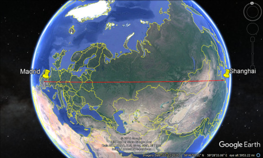
You can walk in a straight line from Madrid to Shanghai without hitting a major body of water using Earth’s curvature.
Egg hatching route.
For everyone who says “that’s not a straight line it’s a curved line” please remember that the Earth is round, not flat. Here’s the line, as rendered with Google Earth:
As you can see, the line is straight!
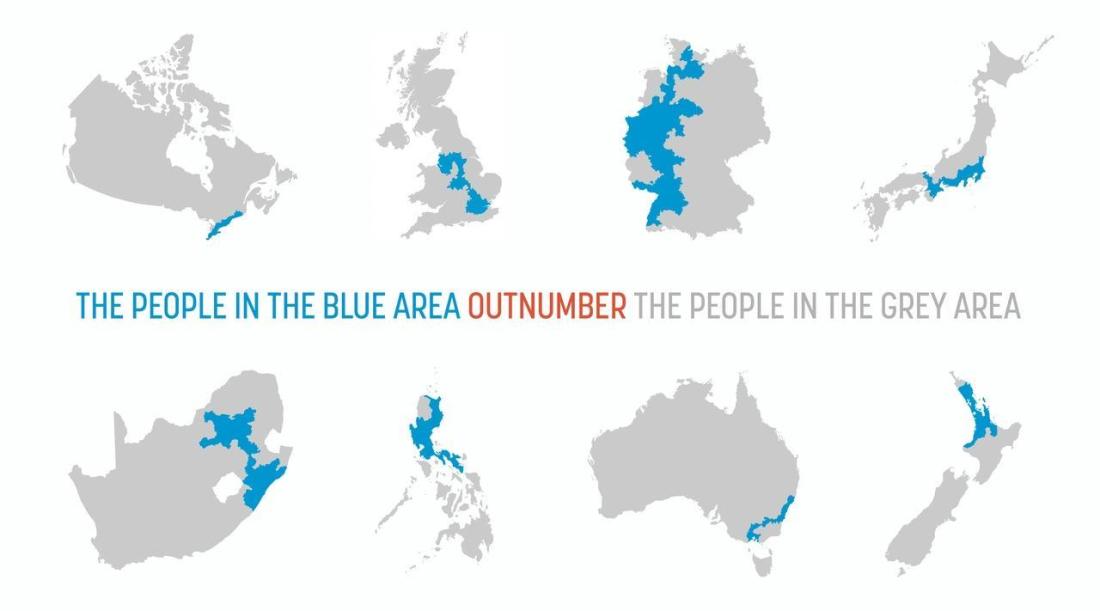
I would walk 500 miles, and I would walk 500 more, but I wouldn’t swim a single mile
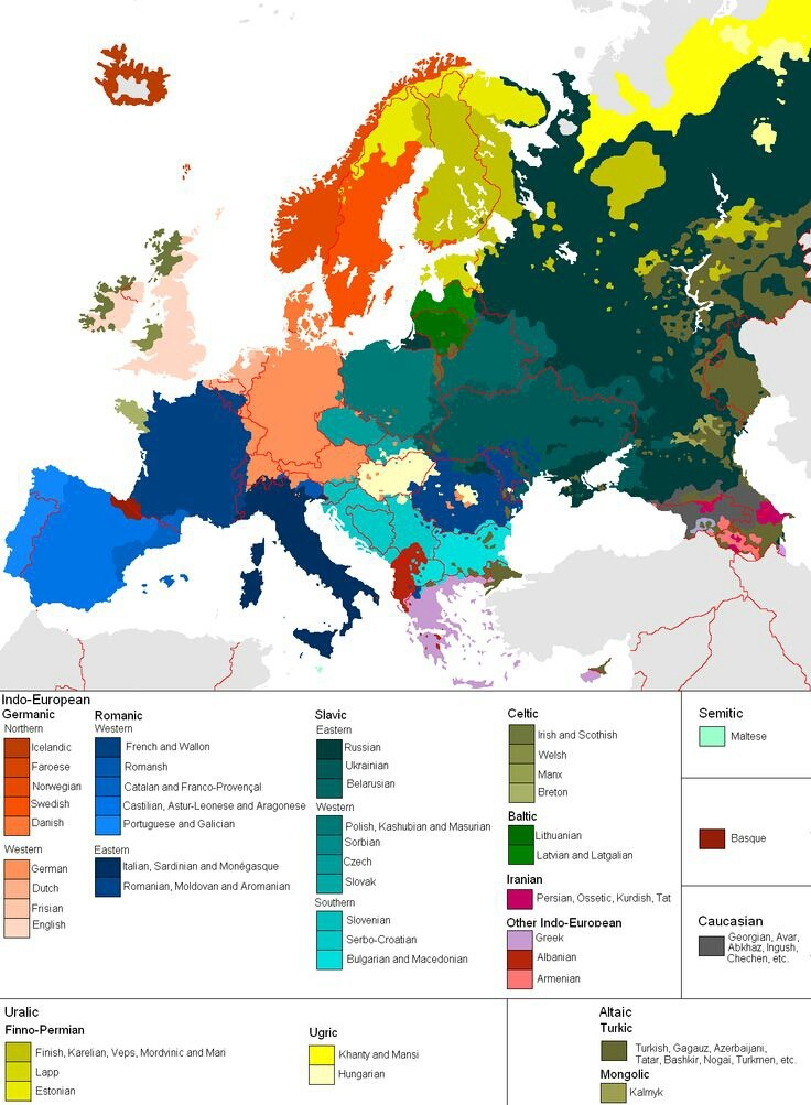
A rather good linguistic map of Europe. Seen in red, the Basque are the sole remnant of the prehistoric Atlantic European megalith builders who once stretched arguably from Crete to Scandinavia. They now only remain on the western reaches of the Pyrenees and the eastern Cantabrian mountain ranges in northern Spain and southwestern France.
The Indo-European speakers on the other hand seem to have originated in the Caspian Sea region of Eurasia, spreading out in all directions in a series of waves beginning as early as 4000 B.C.E., with a final phase around 400 CE known as the great migratory period of the Huns, Germanic tribes and Alans – which brought the Roman Empire to it’s knees.
-H.J.N.
i think my saddest moment as an Australian was finding out that the rest of the world doesn’t say “never eat soggy weetbix” to figure out the order of the compass
Put in the tags where you’re from and how you memorized the order of the compass
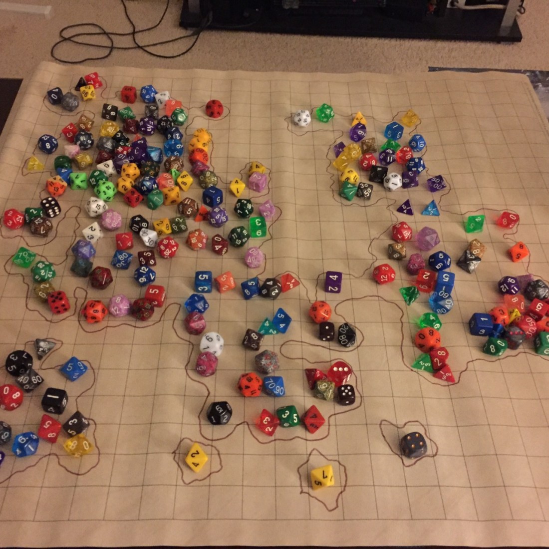
My super advanced mapmaking technique – a handful of dice makes the map nice
interesting method
My question is do the die affect topography any or just set the borders?
I imagine it’s up to the person making the map. But maybe the more dice in a single spot, the more mountainous or forested the area. Maybe choose a few dice to be deemed cities, and some dice for ruins.
Maybe let the dice choose, like a nat 20 would be the world capital, and 10’s would be mountains or something like that.
1-5: Plains and fields
6-8: Forests
9-11: Mountains
12-14: Tundras and snow covered lands
15-17: Farms and towns
18-19: Larger cities
20: Capitals and castles
what would happing if all the dice landed on a 20?
then you have a very busy continent
not all of those are d20s though, so you’d have to come up with another method for the other ones
Adjusted for all dice you might have
D20
1-5: Plains and fields
6-8: Forests
9-11: Mountains
12-14: Tundras and snow covered lands
15-17: Farms and towns
18-19: Larger cities
20: Capitals and castles
D12
1-3: Plains and fields
4-6: Forests
7-8: Mountains
9-10: Tundras and snow covered lands
11: Farms and towns
12: Larger cities
D10
1-3: Plains and fields
4-6: Forests
7-8: Mountains
9: Tundras and snow covered lands
10: Farms and towns
D8
1-4: Plains and fields
5-6: Forests
7: Mountains
8: Tundras and snow covered lands
D6
1-3: Plains and fields
4: Forests
5-6: Mountains
D4
1-2: Plains and fields
3: Forests
4: Mountains
Holy shit. Definitely using this.
I swore at how simple this motherfucking thing is. You’re all bastards and i love you.